Discover our adventures here!

Latest

MT. Tapulao – A Long Walk to Remember

By En
26-29 November 2010
Iba, Zambales
(2037 MASL)


(This post is long overdue. Maybe to mimic the nature of this climb, this post also needed some MAJOR preparation to get it done.)

To prepare for the highly anticipated Mt. Pulag climb of KPMS, another major climb was organized to help stretch our muscles and build our endurance for the challenge of Pulag’s Akiki trail.

Arriving at the headquarters, aka Ma’am Kheix’s abode, it was clear that packing required more fuss and preparation than usual. To avoid holding back the group, weight has to be distributed to our respective packs, perishables tightly sealed, and provisions adequately calculated; understandably so, because unlike the usual fun climbs, this required three days and two nights of roughing it out on the trail.

After a buzzer-beater arrival at the Victory Liner Terminal in Caloocan, the 13 of us we were off to Zambales as the clock struck midnight officially starting the long weekend before us.

DAY 1: Rough start

The bus dropped us off at what seemed like the middle of nowhere. It was dark out and we had to adjust to the darkness before we saw the trike which would take us to Brgy. Dampay Salaza, the jump off point – a 45-minute ride from the highway.

As it was barely dusk when we arrived, the baranggay hall was still closed. Ma’am arrived soon enough and accommodated us with what we needed. She kindly assisted us in cooking the rice for our lunch on the trail later that day. Another group arrived moments later, thoroughly psyched for the climb.

By around 6am, we forged ahead, cautiously optimistic after hearing the admonitions from a couple of members describing the “long and winding” Tapulao trail. Sir Erwin,

one of the guests who has been to Tapulao, described his experience as a test in patience, as the trail just goes round and round (paikot-ikot), seemingly endless.  He decided to return due to the bad weather they experienced previously. He shared that they had to set up an emergency camp as there was almost zero visibility on the trail due to the fog.

We all hoped for a better weather.

It seemed the other group was more than optimistic though, telling us that they planned to reach the bunker for lunch. We had to ask, “Lunch today?” Because unless you don’t have lungs (a common ribbing directed towards mountaineers who have high endurance), the bunker was still roughly 14 hours away on a full load, and like us, they were loaded.

The impossibility of their IT became more apparent when we, ourselves, were unable to follow our objective to take our lunch on the 1st water source. Drained from the steep ascent for the first leg of the trek, we decided to take our lunch when we couldn’t spot the water source. The road was rough and rocky, the sun scorching hot. Towards the afternoon, it started to cool down with some isolated drizzle.

A few hours into our trek, I was already feeling the pain. Our group has broken down into three – the advance team aka mga halimaw (monsters), the team lead team aka Sir H and girl power, and the sweeper team aka the-reluctant-Nelson-and-Samm-with-the-rest-of-us-weaklings. 😀 It was clear that this was not going to be one of those fun climbs organized before. On my part, as I was unable to join KP during the Tarak climb, this was technically my first major climb. And major, it is. Suddenly, Sir H’s persistent reminders for us to keep fit came flooding back. Too little too late for me, I’d say. Thankfully, help came in the form of raucous 4x4s.

The rough riders intended to camp overnight at the bunker and graciously offered to take our load and drop it off on the 2nd water source where we would be camping for the day. How can you say no to that?

The advance team, as they are advanced, was already settled in by the time we ambled our way to the camp site. Bad news came when Sir H and Kheix found out that their sleeping bag has gone missing. Not letting it ruin the entire climb, they decided to investigate the next day for when the 4×4 group comes down from their overnight stay at the bunker.

Quite a workout from months of hiatus from trekking rendering me, in particular, drained and suffering from a major migraine. So, I settled in early after dinner, knocked out cold. Ask the rest how the rest of the “no socials” night went. I was happily dreaming by then.

DAY 2: Welcoming the cold, the pines, and other-worldly presence

My eyes refused to open, dreading another day of endless trekking. Thankfully, my muscles didn’t seem to suffer as much from the previous day’s events. Even more encouraging, Wilson, the newbie who was forced (ehem, Sir J) to go major for his first climb, looked ready and enthusiastic to reach the summit. Or maybe he just wanted to get it over with. Either way, it was a good way to start the 2nd day.

One dark cloud hovered though, it was official, the sleeping bag, crucial for a warm and comfortable sleep up top, was missing. The 4×4 group couldn’t find it. So we moved on and treated it as an offering to spirit of the mountain in exchange for a good climb.

We split into three groups again, the halimaws well ahead of the rest of us. The trail was less steep than the previous day, the air cooler, the vegetation more lush, and the scenery more stunning. We finally caught sight of the pine trees Sir H promised would take our mind off the fatigue. He was right.

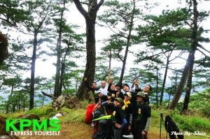
The appeal of Tapulao fully unveiled itself with the wide trail lined with pines, which this highest peak of the Zambales mountain range is named after. Dubbed “the poor man’s Pulag” and “Little Baguio,” Mt. Tapulao draws mountaineers for the cool climate and multi-tiered vegetation similar to Mt. Pulag (rainforest-pine trees-mossy forest). Chromite ores are being mined here, so we saw piles of them on our way to the bunker.

Making the most out of the scenery, cameras came out and pictures were taken. On the trail we caught sight of the popular trekkers’/beach lovers’/campers’ destination – Anawangin.

Detour: We re-grouped at the guard house and discussed our option for the camp site. We gathered information from the 4×4 group that the bunker was no longer there, so Sir H suggested we camp at the “secret camp site” by the entrance going to the summit. To further encourage us, he said the trail’s easier compared the steep assault we would have to face if we continue on to the bunker. Decision’s a no-brainer, we went for the “secret camp site.” So went left and faced a relatively easy ascent.

Once at the clearing, a great little spot with a great vantage point for the sunset, Sir H decided to investigate further into the mossy forest and check the other camp site option, a mere 30-minute trek to the summit. He took Maku while the rest of the guys went down the precipitous path to the bunker (still there, apparently) in order to get some water.

When all got back, it was decision time: stay and have a longer trek time to the summit or forge on, fully loaded, for a camp site nearer the peak. Majority won and we stayed and camped by the entrance. The reasons presented were all good and logical, we were loaded and the forest ahead is denser which would slow down the pace and drain more energy especially for those who just carried liters of water up the assault path from the bunker down under.

Later though, during the always entertaining socials, the more creepy reasons came out as to why some opted to stay in the clearing than forge ahead to the dense forest. Sir Gary admitted to having seen a not-so-pleasant presence hovering while he was answering the call of nature which explained why he was adamant on staying put. This started the onslaught of ghost stories. Let’s just say that some of the stories effectively made me stay away from some mountains I’ve climbed, and some made me want to explore the others.

Stories are all well and good. Whether you believe in spirits or not, they serve to remind mountaineers not to underestimate nature and to always remember to treat the environment with respect.

DAY 3: Frozen at the summit and laughing all the way home

Bright and early Monday morning, we ambled our way to the summit. Sadly, the same way as we were struggling with the cold, the sun was having trouble overcoming the thick fog. So we ended up not getting the clearing we wanted, but we did “find” a good view deck. There’s none of the sweeping 360 view, or the precipice great for a photographing on-the-edge shots; in fact, the summit was marred by a big hole. But we managed to make the most of it, taking pictures, huddling to keep warm, and playfully threatening to push each other over the edge.

We gave up waiting for the sun to show, so we navigated the labyrinthine path of the mossy forest and found our way back to camp for a hearty breakfast.

We broke into groups going down, playing off each other’s energies to get a feel of our respective pace. Some mountaineers tend to relish the trail going down as the pacing tend to be much faster, others just can’t wait to reach jump off and clean up, while others with injuries take their time – we got them all for this climb. Nothing serious but this was definitely a long walk to remember for all of us.

More things went missing on the way down: a Mountain Hardware jacket, a TNF cap, a lucky necklace etc. But we were alive and well, there’s nothing more important than that. Although, should you see a well-dressed person in Mountain Hardware sleeping soundly inside a comfy sleeping bag, call us!

Slight injuries and missing items aside, we got a good laugh on the way down with a hilarious prank that’s become a staple story in KPMS. Let’s just say it involved a shoe, a rock, some scheming mountaineers, and an unsuspecting KP member.

Wrapping up a majorly fun climb

Another major climb done, another event safely locked up into the memory bank. Whatever happened to the other group who planned to reach the bunker for lunch on Day 1? Well, they didn’t make it on time, to say the least. As in everything, plan well, never underestimate the mountain, and come prepared. Otherwise, prepare to huff and puff like your life depends on it.

See more Photos here.

MT. Tarak Ridge – Together Again for a Major First Time

by Tin
13-14, November 2010
Mariveles, Bataan
(1130 MASL)


This climb was 10 months overdue. I can still remember when our team lead, Sir H (before “abandoning” us for Arabian nights) told stories about Tarak, where apparently, bayawaks stealthily crawl and steal your food, that after three minor/fun climbs we ought to do some serious climbing already, and that Tarak is a perfect adventure to experience a first major climb. And so it really was, and was worth the wait (though minus any bayawak sighting).

Tarak Ridge sits at Mt. Mariveles’ west face. It’s situated in Mariveles, Bataan and the jump-off point is at Brgy. Alas-asin (later, we found out we can tweak this to “malasin” but that’s jumping ahead of my story!). At over a thousand meters high, it’s considered as a major climb with a difficulty of 4/9, but yes, some climbing freaks…er…enthusiasts do consider this as a day hike.

We met at 2 am to catch a bus going to Mariveles. We used the 3-hour ride to snooze and get some needed rest (at least enough rest that a moving bus will allow), which Sir H warningly told us we will really need. Joining us were Sir Sam, Sir Nelson and Sir Richard for the first time, and Sir Maku (who previously joined us in Manalmon). And then of course after several months, the KP group was back in action!

At 6 am, Mariveles was covered with fog, and because it was raining everywhere during the past days, we were worried about the extra challenge the rain would bring. We registered first at the baranggay hall, and after doing some quick stretches and our usual prayer,we hurriedly started trekking at around 6:30 am after finding out that a couple of groups have already left ahead of us. Not to be competitive or anything, but aside from an imminent downpour, another worry is finding a good spot to camp at Papaya River which was our first stop for lunch so we really needed to hurry.

The first leg of the trek leading to the jump off point was a somewhat cemented road with lots of extra mud that clung to our shoes. By the time we arrived, our shoes probably weighed a ton.

Sir H was greeted warmly by Aling Mering the “caretaker” of Tarak like a long lost son. Here was another customary registration and some photo ops. We were amazed by the display of banners that were lined up by numerous outdoor groups who have successfully climbed Tarak. And of course became excited at the prospect of hanging our very own banner (which we had printed and brought for the first time).

P for Peanut and Papaya

By 7 am we were right on time and headed to Papaya River. If our shoes weighed a ton during the first leg of the trail, it was nothing compared to the “peanut butter” trail we passed through here, where our shoes and legs felt like they were forever stuck to the ground deep in mud. Nevertheless, the trek was quite easy (yey! no rain!), the first stretch was part grassland, and then a continuous forested 30-40 degree trail, with some downward trek. After an hour or so, there was a tricky trail where the rope we brought came in handy as we used it to rappel down. Other than that, I knew my 2 months of jogging to prepare for major climbs was paying off.

Together with his constant stream of trail jokes (and banters with Master Jun) , Sir H was also prepping us for the trail after the Papaya River which will be much more difficult, so we needed to arrive early to have our lunch and get enough rest and leg power. Hence, he kept saying we’ll “take 5” at the next so-or-so stop, but there were really never any “take 5.” We just kept on and on (and even overtaking one group).

Around 10 am we set up camp at Papaya River. The blast of cool air coming from the river was a big relief. We did get a nice spot, near enough to the river but not too near that we’ll get splashed with water by a bunch of frolicking tourists on a picnic. We did some frolicking in the water also when we refilled our water, ate our packed lunch, set up our hammock, had our quick nap and generally rested.

12 noon came too soon. As it is, by now, I’ve already learned that you’ll never really realize your muscles are aching until after you’ve rested. And so it was aching,but we had another 3 more hours of climbing to do. If it were a regular fun climb, Papaya River would have been the campsite already and the summit would have been a mere 30 minutes or so away (not 3 hours away). By 12:30 we were packed and ready to go.

5 minutes nalang

And yes, the next leg proved to be very challenging. It consisted of forested and very steep slopes (where the roots provided us with nature-made ladders) and if you looked up, you’ll wish you hadn’t. The trail seemed to be an endless upward climb to infinity and beyond. Here was where Sir H’s yells of “5 minutes nalang!!!” translated to “forever minutes nalang!!”(yes, the 5 minutes was a joke but was meant to be encouraging). Soon, the group was divided into 3 more groups as we climbed at our own pace.

I was ahead with Sir H, Mam Keiks, Master Jun and Sir Richard. Around 30 minutes or so before the campsite (I didn’t know it then), Master Jun, the “halimaw” that he is, went back down to pass instructions to the other groups. I opted to wait for him, and sat down (more like slumped down), while the rest went ahead. Forest silence and utter exhaustion, I know could play tricks to people with hyper imaginative mind, so when I suddenly heard someone calling my name or I thought I heard someone echoing my name, I ignored it and instead tried to hum songs in my head. As the voice sounded nearer, I realized it was only Sir Jay with Sir Sam catching up with me (talk about paranoia, he just laughed when I said I thought some weird entity was calling me). Master Jun soon caught up with us and trudged ahead while the three of us followed. The campsite was a welcoming sight!

We set up camp, not in the saddle camp (where we’re supposed to) because it was already full of early campers (our 4 pm arrival apparently wasn’t early enough). We were around 20 meters or so away and had to clear some tall grass to pitch our tents. As the winds at Tarak can be very harsh during the night at the saddle camp, we realized we were lucky since we were sort of nestled behind some trees whereas the saddle camp was bare in every direction).

With some new faces, socials that night (after a special chopseuy and tinapa dinner) was a lot of fun! Sir Sam apparently got bored with his work-gym-house routine so he decided he’ll try mountain climbing (and a major climb to boot!); Sir Richard, lugging a bulky camera (thanks to him we had great photos!) didn’t really need to explain why he came along; Sir Nelson, who’s been climbing already wanted to join us and experience Tarak; and Sir Maku (a.k.a. my cousin) I just had to drag along. Around 11 pm, our socials were hampered with drizzle but we were prepared and brought out a large tarp, tied it to the surrounding plants and trees and used it as a make-shift roof. By 1 pm we snuggled in our tents warm with guzzling down our usual Gran Ma.

Living on the edge

I woke up just before 6 am and decided to go out and catch the sunrise (no such luck, it was very foggy and the sunrise was on the other side of the mountain). By 7 am, after having coffee we explored the summit and all the way to Tarak’s Ridges. And explored, we did! The camwhores were photo-deprived during the ascent, so we just had to spend 3 hours at the summit and at the ridge taking lots of great pictures that looked like we were on the edge of the earth. The path to the ridge obviously hasn’t been trekked on (for months by the looks of it because campers usually just ascend to the summit and seldom trek past it), you needed to bend over to pass through very thick and thorny plants. But based on the photos, with the group proudly showing off our t-shirts and KP banner against the backdrop of a clear sky and clear view, you can tell it was worth it.

We headed back to the campsite for a brunch and by 2 pm started our descent. We were the last of the overnight campers who descended. But, as we were having our brunch, there were several more day hikers who came including a couple of Japanese-looking tourists and a Westerner.

Going down, aside from the usual knees and toes torture it usually brings, was uneventful, except for Master Jun’s phone call to his wife (yes, the signal was very strong) and finding out that Manny Pacquiao has won (again!) and the one wrong turn we took but thanks to Sir H’s experience, we found our way back instantly. We had a quick stop at the Papaya River by around 3 pm. And just when I thought the torture was over, I’ve forgotten that some of the path going to the Papaya River was a downward climb, which meant, to descend, we actually had to go up. By this time, I was ever so grateful for the walking stick my cousin gave me and the energy bars Sir H shared. The foreign day hikers trekked past us, and at that point, I so envied the Westerner’s long legs and was on the verge of asking him if I could just cling to those legs of his and go with him (but modesty prevailed! hehe).

By 6 pm, we were back in civilization (somewhat!) Aling Maring sells oh-so-yummy buko juice back at the jump off point, we wolfed down two orders within seconds of arriving. But we still had another 40 minutes or so of walking to do, to get us to the Baranggay Hall at the town proper. Upon hearing this, her husband scoffed and laughingly told us it will take us 40 if we sleep on the trail. He braggingly said he can walk in less than 15 minutes with his damaged foot.

It did take us less than 40, but not less than 15 (we’ll never compete with locals!). So here is where I dubbed thee, Brgy. Alas-Asin to Brgy. “Malasin” (well to be grammatically correct- “minalas,”meaning being overcome by bad luck). I was the third one to take a bath (we could only use 1 bathroom, because the girls’ was, I’ve forgotten why, but Kheix and I couldn’t use it). It was about 7 pm when I went out, fully refreshed and ready to go, when I found out we’re having an impromptu socials because we missed the bus back to Manila and had to wait for 1 am for the first trip. I thought they were joking and had to ask the baranggay officials themselves before I finally realized it wasn’t Sir H’s usual prank. So we settled in at the 2nd floor of the baranggay hall, some snoozed and the others had the patag, alcohol-free, coffee-filled version of socials and waited for 1 am.

In the middle of all those sweat, sore muscles and cursing your bag, wishing it had its own legs and GPS, most climbers will often ask themselves why put yourself under torture?  Yes, why? (when we could’ve been at home, watching another historic Manny Pacquiao fight or at the mall, ascending escalators, not roots). As the first of a series of major climbs, for most of us in the group, it’s a really serious climb compared tothe usual fun climbs we had before. Aside from communing with nature, it’s also a self-test of much more than your physical strength, but more of your patience, discipline and more importantly, sheer will and proper mindset. Either you fail yourself (and realize mountaineering isn’t really for you) or pass yourself and be worthy of a next climb. (Post note: we passed! And the next major climbs we were all together with another major story! )

See more Photos here.


MT. Timbak – The Sacred Ground

by Sir H
29 October 2010
Atok, Benguet
(2,717 MASL)


I’ve been to Baguio a couple of times but I have never tried to take a side trip near the city of pines like Atok, Benguet which I discovered to be a new place for hiking and enjoying the   panoramic view of the place. The Mountain of Timbak was a great experience for me to relax and spend glorious moments while on vacation. The height of this mountain is about 2,717 MASL, and considered the 9th highest mountain in the country.

The mountain caught my attention during my stay on the other side of the globe and this side trip was planned 1 month in advance. It was early morning of Friday, the 29th of October, when we packed our things, bought a ticket from the slaughter house terminal and took a bus to Besao via Sagada – a 3-hour travel from the province of Baguio to the town proper of Atok.

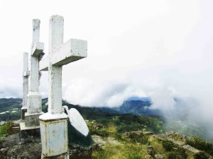
The start of the trek from jump off kilometer 55 was quite challenging with a path of about 30-40 degrees of elevated cement road leading to a fork in the road going to Timbak Mummies and to the summit. Along the trail you can see the picturesque rice terraces of Benguet which took my mind away from the cold weather and feelings of exhaustion. The locals from Timbak were very helpful in providing us with directions. When we passed by as they were tending their vegetable farms, they were quick to smile and point the way.After two and half hours of hiking, Kheix and I reached the summit of Timbak (Singkalsa) where the famous three white crosses with some statue of nuns and angels can be seen. At the summit, you are greeted with the fascinating view of rice terraces, Halsema high road and Cordillera mountain ranges coupled with the cold and foggy weather that can go as low as 14 degrees Celsius.

We ate our lunch near the white cross after the so called “pictorial” and decided to visit the Timbak Mummies on the other side of the mountain. I would recommend this side trip for you so you’ll see the traditional grave yard of the tribes of Timbak, you’ll be amazed with how they preserved the bodies of their ancestors.

Depend on your pacing it will take 3.5 to 4 hours of trek going down to Km. 55 and get back to the road going to Baguio. It was a very fulfilling adventure day hike spent with a loved one while trying new things and communing with nature.

See more Photos here.


MT. Daraitan – Going with the Flow

by Doreen
16-17 October 2010
Tanay, Rizal
(719 MASL)


We set off to Daraitan hoping to repeat our immensely satisfying adventure in Manalmon with the spelunking activity on the side. Instead, we were handed a box full of chocolates of the bittersweet variety.

Joining us for the very first time in Daraitan were Karen and Tin-Tin (not to be confused with resident KPMS member Tin aka Mang Kris). We ran a bit late with our ETD due to a latecomer who shall not be named (*wink*), hence giving us time to get to know our guests. Karen, we had already met (virtually) via one of our members, and Tin-Tin was the brave soul who reached out to KPMS expressing interest to join our Daraitan trip via the wonderful invention that’s Facebook. Vera, our unofficial photographer and adopted KPMS member, was also present for this homecoming climb of our resident Amboy, Sir J (There’s no place like home, eh?).

After “the latecomer” showed up, we took the jeep to Tanay, Rizal pumped up and ready for the adventure to begin. Some shared laughter, photo ops, and cat naps later we were hopping on to another jeepney bound for Daraitan, where we waited… and waited some more for it to be on its way. This was our second speed bump on the road – quite a bit of waiting and a very dusty and bumpy ride ahead. I imagine it was even more challenging for some KPMS members on the top load of the jeepney. Lesson learned: check ahead of time about scheduled departures of public transportation, otherwise you’ll kill more time than you can afford.

But on we went, and after a few grumbles, we regained our good-natured mind-sets and shrugged it off, commenting in jest, “Sira na naman ang IT (Our itinerary’s messed up again)” – a ribbing common in KPMS as we tend to improvise and stray from stringent ITs.

Two rides and a few hours later, we arrived in Daraitan where we took a boat ride (always fun) to the registration hut, then took a trike to the barangay hall where we finally got some sustenance.

Fully satisfied and rested, we prepped for the trek by distributing equipment, provisions (and some potent beverage) among us, and then went on our way.

We ran into the third speed bump halfway through the trail to the camp site. Mt. Daraitan, according to www.mountainsmount.com, reaches up to 719 MASL, but we barely scratched the surface. As explained by our “delightful” guide, the summit of Mt. Daraitan is not yet established. It would take 3 days, minimum, to reach the peak with danger of eroding soil on steep trails. See, Daraitan is one of those mountains suffering from the ill effects of logging. That being the source of income for some residents, patches of land are bare and the soil suffers from erosion.

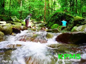
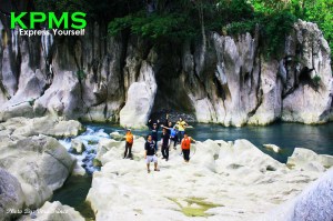
A bit disheartened, and maybe a bit disappointed, the sight of the boulders white as snow and the crystal clear waters of Daraitan river make the trek to the camp site worth it. And since we only stayed at the base to camp by the riverside, we had plenty of time left after we set up camp, and so we spent it frolicking in the hot ‘n cold waters of the river. Quite a moody river that one. J

As the night enveloped us, we gathered round for dinner and socials where “the Chapel” struck again. A bit of drizzle drove us all into the shelter of “the Chapel” – cozy and relaxed. After the rain stopped, we all went back out and marveled at the moon while enjoying each other’s easy banters. We were not the only ones enjoying the lovely night it seemed, as a group approached came into the camp site and indulged in a bit of night swimming.

The next day, we set off to the Daraitan cave for spelunking – another speed bump. This was the more challenging trail. And while the marble formations were a sight to behold, we were treated to a strenuous half hour trek up to the cave entrance only to be foiled by a reptile (the snake!) coiled around a tree by the cave’s entrance. As a snake bite was not part of the plan, we opted to forego this part of the IT and chose, instead, to dive and drench ourselves in the gigantic tub created by nature – a picturesque and private patch of paradise. It was just too bad that some insensitive trekkers chose to immortalize trivial things with vandalism.

It’s good to have plans, but great memories are made of instances of ingenious improvisations in the face of unexpected turns. Like the water that flows through the rivers of Daraitan, we should learn how to go with the flow and allow life to surprise us once in a while.

Life’s little inconveniences teach us that we can’t have control over everything. And when things don’t go as planned, well, it’s really not worth stressing over.  Adventure trips are stress relievers, getting strung out on details defeats that very purpose. With the beauty of nature spread out before you, who can resist the urge to just lie down and take it all in?

That, in a nutshell, is what this trip was all about.

See more Photos here.
 

MT. Manalmon – Reaching New Heights

by Doreen
10-11 July 2010
San Miguel, Bulacan
(196 MASL)


At this point, we were all familiar with the steep terrain typical in mountaineering; hence, we wanted to test ourselves with a different kind of adventure. Mt. Manalmon promised just that, for while this has to be the lowest mountain we climbed thus far, it proved to be the most adventure-packed trip we’ve taken.

Located within the historic Biak-na-Bato, the numerous caves found here served as the refuge of revolutionaries like Emilio Aguinaldo during the Filipinos’ revolt against the Spanish Conquistadors. So aside from the usual trekking, this trip promised a taste of spelunking for the participants, going through the thrill of rediscovering history from the cracks and crevices of the caves-cum-hideout. Plus the inviting waters of the Madlum River at the base of Manalmon make for a refreshing break on your way to the summit.

We were joined by two guests in this climb – Maku and Aron. Both guests were newbies in mountaineering, and they were in for some serious workout.

While we knew that there’s going to be rivers flowing along the trail, those wearing trek shoes didn’t want to wade into the waters at the beginning of the trail, opting to step on rocks instead and mustering all the balance just to stay dry. But, as luck would have it, they ended up teetering and splashing into the waters generating laughs from the rest of the sandal-clad group. Yes, oftentimes in nature, resistance can be futile.

After a brief rest at the jump off point, talking to the guide and arranging the itinerary for the 2-day activity, we gamely sorted out our things, distributing the weight of camp equipment among the group and went on our way. Arriving at Madlum River, we stopped for the customary picture-taking and walking barefoot into the waters. As the water was a bit murky at the time, we opted to forego swimming in the river and just enjoyed the feel of water splashing on our feet and the sun on our faces.

We then started the ascent to the camp site. Though I said that it’s the lowest mountain we’ve climbed thus far, it proved to be a challenge for a member of the group who carried more than her usual load. Thankfully, it was a relatively short trek and before we knew it we have reached the camp site, which wasonly a few meters away from the summit. And while we would have wanted to lie down a bit more and savor the cool air from the summit, the threat of the approaching dark clouds prompted us to set-up camp immediately. Of course, while pictures where taken for posterity.

Then the sky cried, forcing us to take refuge in our respective tents. Even cooking of our dinner and the socials had to take place inside the shelter of the tent due to torrential rains. Fortunately, one of the tents we brought was gigantic! It could accommodate all of us earning its title as “The Chapel”. And because of its size and its conservative nature – it came with a separate layer for partition.

After a night of merry-making and sufficient libation, we woke up to a glorious sunrise. Coffee was prepared and we made our way up the summit, savoring the hot and aromatic beverage while staring at the rising sun – a beautiful shade of fiery orange. With the view of the sunrise and early morning fog, you’d think you’re 2000 meters up, instead of only 200 meters!

Breakfast was served, with the KPMS’ favorite garlic bread (secret ingredient courtesy of Sir H). Fully satisfied and wide awake, we descended and prepped for the next wave of muscle stretching – spelunking. Little did we know that our biggest adventure would come prior to that.

Because just when we have dried our clothes, we were told we’ll be crossing the river (again!) to get to the caves. Because we didn’t want to be soaked while spelunking, we asked our guide if there was any other way to cross the river without wading through, and that’s when he pointed the wires!

Because we didn’t want to get wet, we ended up traversing the width of the river hanging several feet above it while balancing ourselves between two wobbly wires, knowing that some of us can’t even swim. Talk about death-defying!

We all got through it, with the support of the group, and the encouraging words from some locals. That’s KPMS, always aiming to reach new heights…

… and lows, as we gathered our wits and mustered composure for the descent to the caves.

We passed by two caves – Madlum and Bayukbok Caves. Madlum was small and only served as a gateway towards the bigger cave, Bayukbok. I have to say, claustrophobia has no place in spelunking, because aside from the darkness, you have to go crawl through tiny passages and squeeze your way into cracks and crevices. A couple of ladder-aided walls and several cramped spaces later, we emerged into the sun and capped off the spelunking activity with root rappelling aka “Romgil rappelling” because most of us held on to Master Jun instead of using the root to swing to the ground.

Definitely an adventure-packed weekend with KPMS capped with a hearty meal courtesy of Master Chef, Kuya Jun. And after previous guests and MIA KPMS members saw the pics from this trip, they’ve been urging us to plan another trip back, so watch out for that!

See more Photos here.


MT. Pico de Loro – The highs and lows

by Doreen
10-11, April 2010
Ternate, Cavite
(664 MASL)


Some members of KP have already climbed Mt. Pico de Loro, so-called because of the peak’s resemblance to a parrot’s beak, but as some still had unfinished business not having climbed the Tower when they last trekked Pico, we gamely organized and invited people to this trip. This time though, we resolved to have everyone conquer that vertical hunk of rock, even the first-timers from our guests.


For this climb, there were 14 of us all in all, the biggest group since our Mt. Maculot climb. We had seven guests: Vera, Hannah, Trina, Marc, Adonis, Jill, and Alex. Hence, it was quite a treat to meet new faces who share the same love for nature. The jump-off at the Magnetic Hill gave us time to stretch for the 2 to 3-hour trek to base camp. The trail is relatively manageable with the moderate slope of the ground. Some parts became steep nearing the base camp but with a few helping hands from the group, any hurdle was a cinch. That was until we took a wrong turn.

Lesson learned: DO NOT IGNORE warning signs. Seeing three rocks piled on top of each other – that’s a warning sign. We started ascending, the slope getting steeper and steeper, and just when we though we were nearing the camp site, we climbed some more.

We reached a viewing deck where we saw the camp site… on the other side! All good though, because the view was stunning!

So, the minor climb leveled up, and the usual 3-hour trek took almost 4 hours, but then again, unpredictable events are the stuff of good stories. This is no exception.

When we finally arrived at the camp site, we looked up and saw Boy Scouts marching to the summit. Their Master Scout approached our camp and looked up with pride to his boys enthusiastically taking in the view from the summit. Meanwhile, our group decided to postpone the trek to the summit for the following day as it was already getting dark.

Dinner and socials were gritty in all sense of the word. Partly because the wind was howling, spraying sand and dust our way. Nevertheless, we made the most out of the wind and stuck it out under the night sky to get to know new friends. The wind even brought a beautiful red insect our way which we naturally captured with our lenses.

The next day was the big trek to the summit then to the tower. Upon reaching the peak of this beautiful mountain, a signboard erected by some religious sects marred the perfectly good view of Pico’s peak. Some of our member then decided to take the matter in their own hands by dismantling the sign. Mountains are, after all, sacred, hence we should be responsible in preserving its raw beauty instead of staking claim that’s not ours to make.

From there we could already view the imposing rock reminding us that there’s a final hurdle to this climb.

We were lucky to have clearing that morning lessening the risk of climbing the tower. Because while balance, coordination, and focus are essential to get to the top of the tower, unforeseen natural elements such as low visibility due to fog/smog can make the ascent all the more dangerous. Thankfully, the sun was happily shining down upon us.

One by one, the more seasoned climbers helped each one reach the top, all in the spirit of bayanihan.

Though not all of us were able to climb the tower, for various reasons, we all shared the natural high accompanying the group’s sense of accomplishment. After that, packing up and going down the well-trodden path to civilization didn’t seem so hard anymore.

Many mountaineers list Pico as one of their favorite minor climb destinations because it has something for everyone – trekking, rock climbing, even swimming in the cool waters of the falls. That last part we missed though because it was the dry season. Maybe next time.

(Side note: Pinoy Mountaineer, www.pinoymountaineer.com, has listed Mt. Pico as one of the “mountains of environmental concern” due to the accumulating trash left behind by irresponsible climbers. Remember the maxim: “Leave nothing but footprints, take nothing but pictures, kill nothing but time.”)

See more Photos here.


MT. Gulugod Baboy – The Beach and the View-tiful

by Tin
20-21, February 2010
Anilao, Mabini Batangas
(525 MASL)


So what do you get when you combine a premature summer heat, a 90% open trail and the sea? Sunburn! Yes, despite all worries that came up leading to the day of the climb (which included rumors of not-so-friendly locals bullying mountaineers with homemade paltik guns, last minute shopping and marinating chicken until midnight), we can say that as mountain lovers also doubling as beach worshippers, this was one of the ahons we were really looking forward to (with a promise of a mountain plus sea combo).

Mt. Gulugod-Baboy or GB is situated in Anilao, Batangas and the drop off point is at Philpan Beach Resort. GB is also often referred to as mini-Pulag because its three peaks offer an awesome 360 degree view of Batangas beaches, that stretches even as far as Oriental Mindoro.

For this climb, we rented and squeezed ourselves in an FX from Manila to Batangas. Manong Driver regularly goes to Anilao during weekends and takes mountaineers with him. Anilao, although a popular diving destination, is still quite hard to reach using public vehicles, so renting one is advisable. Trina, a college buddy of two of our members joined us for the first time, as well as Vera who now became a regular.


At around 11 am we arrived at the drop off point. As the campsite/ summit is very open, we decided to start our trek at 2 pm to avoid getting fried at the campsite. We killed some time and used our more or less 3 hours : eating, napping, sound tripping, stretching, picture taking (while stretching!), visiting the nearby beach and getting excited with the prospect of swimming as much as trekking. By 1 pm, we became quite worried because several groups of mountaineers have already come and gone. But we were assured by the locals that GB’s campsite can accommodate even a 10,000-people concert, so finding a spot to camp was not going to be a problem.

We started the trek through a concrete trail, and at the end of which there was a sari-sari store where the concrete ends and the forest begins marked by a short tricky steep ascent. After that, the trail continued easily with a view of the beach at our back and extra sweat trickling down our backs due to the summer heat.

The next rest stop was a kubo that sold a very yummy (and thankfully refreshing) coconut flavored iced candy. We were all in agreement, that yummy iced candy alone made the climb worth it. The rest of the trail was like a walk in the park.


The late afternoon view from the campsite was amazing. Aside from the 360 degree view, the campsite and the peak itself is a spectacle. Sunset provided us with some of our most memorable photos, including our favorite “reaching for the sun” creative shots. And while pitching our tent, the sky provided a backdrop of splashing colors which looked like an artist’s canvass in painting action. The only thing that marred the paradise on earth feeling was sweeping horse and cow dung to make way for our tents. But it was a small matter, GB couldn’t disappoint us.

It was still surprisingly cold during our socials that night (considering, summer was on its way and we were sweating it out during the trek.) Socials consisted of our regular feast, topped with an aborted trek to the summit at 3 am and an attempted stargazing at 4 am.


Morning provided equally amazing views, and more photo ops, one of which was our now infamous “kung fu fighting photo”. Our descent’s highlight was passing by the kubo again to enjoy melon-flavored iced candy.

Earlier that night, the group decided to forego visiting the popular Sombrero Island because there was no way we could make it down the mountain by 8 am and we were advised that if we go beyond that time, there was a huge probability that we’ll be swallowed by a high tide. So by 12 pm the next day, we were excited bangka riders off to explore the other side of Anilao – its fishes and corals. We ended up at Sampaguita Island, delighted to exchange our backpacks to life vests, our trek shoes to sandy bare feet, and our bandanas and hats to goggles.

GB’s experience was like a walk and a picnic in the park and a daytrip to the beach. It was literally a picnic, where we even met a couple of families bringing along their kids and babies. A fun climb indeed.

Prior to the climb, we heard quite frightening stories and rumors about local bullies. We encountered none, but friendly locals who gave advice and warnings particularly about asking for directions. They say some mountaineers just ignore them (bordering on rudeness) and do not heed their advice, which often resulted to wrong turns and a lot of backtracking. Locals treat their mountains as their home, and as mountaineers we are only visitors. One of the mountain ethics/ tradition when passing through and meeting locals along the trail translates to much more than saying “Hi sir/ma’am” to them, it’s all about actually giving them the respect they deserve.

See more Photos here.


MT. Manabu – Newbies Exploring

by Tin
30-31, January 2010
Sto. Tomas, Batangas
(760 MASL)


And by exploring, it really meant exploring. Out of all the 10 people who joined the climb, no one has ever been to Manabu and no one really knew the trail. The group just knew that after a couple of climbs, we now have enough guts (and yes, enough knees and leg power) to accept the probability of some backtracking and extra hiking. In the end, it proved to be one of our easiest ahons.

Mt. Manabu is situated in Sto. Tomas, Batangas. It belongs to the Malarayat Mountain range. And a traverse through its neighboring mountain, Mt. Malipunyo is possible (but in this climb, we thought Manabu was enough excitement for now).

We arrived in Sto. Tomas after boarding a bus at around 9 am. The group gathered and arranged our stuff in the town’s public toilet. Passing through the market area to board a jeep to take us to the jump off point, we gamely posed for a (now one of our favorites) “survivor” group photo. Jawo, a childhood friend of one of our members has joined us as a guest and Vera, a sister of one of our members has joined us for the first time (later, she’ll become addicted to climbing as we become addicted to her DSLR as well!)

The jeepney ride was uneventful and we arrived at Brgy Sta. Cruz with plenty of time to spare so we decided to have an early lunch. At the jump off point, there’s a public shelter complete with wooden benches (which proved to be very useful for some of us who took a quick nap) and a long wooden table (which was perfect for our lunch laid out in a banana leaf) including a public toilet where you just need to pay a nominal fee to use.


The total trail length is 4,738.2 meters which was easy enough to follow and several stations/ rest stops along the way made it very climber-friendly and can even be a real treat. One such stop after several minutes from the jump off point is a “dampa” where they sell fresh cold buko juice. There was another station like this where, for camwhores like us, accumulated endless group and individual shots.

The forest was quite dense but there were really no challenging steep climbs. Ironically, the challenge we encountered was not while hiking, but it was after we have rested. We misjudged the trail and miscalculated the amount of time it would take us to the campsite. So upon arriving at the last “dampa” rest stop, after the usual photo ops, playing with the chickens, snoozing, playing with a wooden “bird”, eating our favorite lychee jellies, and lots of laughs all in about 2 hours (for worry that we’ll arrive much too early in the campsite with the sun high up), nobody was laughing and everyone was out of breath when we hiked the last leg of the trail (and as luck would have it the steepest part of the trail) to the campsite. Lesson learned? Proper pacing.


It was only about 4 pm when we arrived at the campsite, and the sun was still high when we pitched our tents, our favorite hammock, and prepared dinner.

The afternoon view was average, and the only excitement was seeing Mt. Maculot, which from a distance stood really tall and it was an amazing realization that we managed our first traverse there just a month back. But when the afternoon changed to sunset, the view was one of the most dramatic we’ve seen and produced the most dramatic photos we’ve ever taken.

Our socials that night was highlighted by Absente (to top the usual Gran Matador-filled night) and a visit to the nearby group of friendly photographers/ mountaineers produced ice (surprise!), Cheese Ring, extra Nestea iced tea and a sense of camaraderie!

The next day, we trekked to the summit that looked like a garden and was marked with a big white cross only about 5 minutes away from the campsite. From there, the descent passing through the grotto was easy.

Because of its easy access, great spacious campsite and sunset views, Manabu is considered as a favorite “fun climb” even by veteran climbers and newbies alike. And it’s no wonder that it can become crowded during weekends (which we also experienced, having been “displaced” at the campsite by a much larger and boisterous group). However, we highly advise mountaineers that outdoor ethics doesn’t only apply to “leave no trace” policy but also about being considerate and respectful of others.

See more Photos here.


30-31, January 2010 (Sto. Tomas, Batangas 760 MASL)

MT. Batulao – A Mountainous New Year

by Tin
2-3, January 2010
Nasugbu, Batangas
(811 MASL)


Barely two weeks since the climb in Mt. Maculot, the group decided to head to another mountain adventure. Call us AHON enthusiasts or AHON addicts, either way this particular climb in Mt. Batulao, technically established the name “KPMS” and proved our love for nature. Just imagine climbing just a day after the start of a new year?

Mt. Batulao is situated in Nasugbu, Batangas and the jump off point is at the Evercrest Golf Course. From around 10 who were originally good to go, only 6 made it to the climb. We crammed in Mam Kheix’s (who also doubled as our driver) Mazda and drove to Nasugbu arriving on time at around 1 pm at the drop off point. There was a sari-sari store fronting the golf course’s entrance where we did some last minute packing and parked Mam Kheix’s car.

By 2 pm we started our trek and two of our members (Sir H and Sir J) trekked ahead of us, half hiking and half running. Within minutes, we lost sight of them as we took a left turn in a crossroad (to our right is the road to the famous Calaruega). Later, we’ll be grateful for their sacrifice and the extra effort, having secured the best spot at the campsite.

The trail started in a cemented road, passing through several communities. We could’ve opted to drive all the way there or ride a tricycle but the parking there wasn’t as secure as it was at the sari-sari store back at the golf course entrance. And besides, where’s the fun of trekking in that? Along the way, we were regaled with funny and sometimes scary anecdotes from one of our climbing cohorts about his past night trek experience climbing Batulao. That and amusing ourselves with any jokes and stories, laughing ourselves silly upon seeing “Kaylaway Elementary School” on the way and avoiding horse dung every now and then, helped liven up our otherwise uneventful trek.

The forest started after passing by the last kubo rest stop, marked by a “Welcome to Mount Batulao” sign post. From the view below, you can see Batulao’s ridges and the whole trail stretches like a golf course and it kinda is. It’s less forested, mostly an open and perfect trail for newbies. The only challenges we encountered on the trail leading to the campsite were (again!) horse and carabao dung. The rest of the trail was sweat producing and breath shortening, but still quite easy.

At almost 5 pm, we arrived at the campsite which was organized into numbers (or organized is probably the wrong word to use, as we got confused with how they numbered the camp spots, something like camp 4 was followed by camp 8, followed by camp 2 etc.). By this time, we were faced with several other confusions as well: having to register our group (do we even have a name?); seeing a make-shift toilet (what’s wrong with digging the eau naturelle way?); seeing a sari-sari store with kids milling about (great, what’s the point of bringing all those boy bawangs?); and where the heck were the two people who made up our advance team??


Shortly after, we settled on (jokingly) KPMS as our name (as in Kalabit Penge, an inside joke); decided that the make-shift toilet was not so bad after all and might come in handy; realized that the sari-sari store which sold cold softdrinks, even at twice the price, might also be a blessing (and you just had to give kudos to those people who climbed and lugged those bottles everyday!); and, as we followed the smell of grilled bangus, thanks to our team lead Sir H, we finally found our camping spot.

Socials that night was a feast with more than enough food for 6 people, the highlight of which is Sir H’s “Soup Number 5” made extra special with grit and gravel. The wind was strong and the evening so dry, we were literally “one with nature” by digesting, possibly an inch, off of the earth’s surface!

The next day, the ascent to the summit was highlighted by an around 2-3 meter “kiss the wall” part that stood in an angle of 70-80 degrees that you need to scale by doing a “four wheel” (simply put, this means simultaneously using your hands and feet, and elbows and knees, if needed, while climbing). It produced a memorable (and only) video of us and some crisp curses along the way. From our campsite, the view of this wall and the summit stood looming and quite overwhelming.

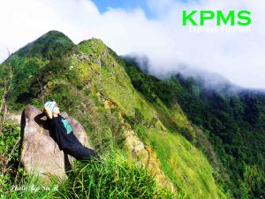
As the sky turned gray with a high chance of rain, our summit experience was cut short by a deluge of flying insects where we only had seconds to take some pictures. Then we hiked to the other side, reaching Batulao’s ridges. The view was stunning. Green stretched as far as the eyes can see.

It began to rain when we started our descent back to the campsite. The trail became very muddy and slippery that the “kiss the wall” part felt very much like “kissing our life away” part. Luckily, our more seasoned members helped the newbies and the “walking butt” trick seemed to help one of our members which earned her the name “MMDA,” having cleaned and flattened the trail by sliding down.

We made it back to the campsite with no other incidents and the weather cleared up. As we had anticipated, the sari-sari store came in handy when we guzzled down a very much needed sugar boost from softdrinks.

Again, trekking back, the same 2 members hiked ahead. And the remaining 4 made it back to the drop off point by hitching in a memorable rocky jeepney ride.

A Starbucks Tagaytay side trip and Mam Kheix’s foggy zigzag speedy overtake (where even the stuffed Elmo toy looked terrified), topped another fantastic ahon weekend welcoming the new year.

See more Photos here.


MT. Maculot – The First Time

by Doreen
19-20 Decemeber 2009
Cuenca, Batangas
835 MASL


For most of us, this was the 1st climb and 1st traverse. This was also the 1st trekking adventure where all members of KP participated together with a couple of guests. Hence, this was ultimately the 1st of many adventures to come.

Arriving at the jump-off point at Cuenca, Batangas, we started to walk through a rough road with a steep climb. Even at the start we already began to feel exhilarated especially as the path became steeper and steeper with our ascent. Before we knew it we had entered the thick forest of Mt. Maculot. When we stopped for our first break, we could already feel the burning feeling from the few minutes hike we took where we had to pull ourselves up at some points along the steep trail.


Arriving at the camp site, out of breath and sweating profusely, we immediately settled to look for a spot to pitch our tents – our shelter away from the comforts of home. After resting and changing our sweat-stained clothes, we started taking pictures and geared up for a trek to the ROCKIES (685 MASL), a steep and rocky (hence the name) precipice overlooking the magnificent view of the Taal Volcano and the rest of Batangas.

The next day, after a night of memorable socials, our group spontaneously decided to go for the traverse trail up the summit then down to other side of Maculot. Being the 1st traverse for most of us, this had to be the biggest challenge we had to go through during this climb. The steep ascent plus the thick vegetation left us exhausted and a little dizzy.


We had to rappel down twice during the traverse. It was intense and it required strength, attentiveness in following instructions, and the gusto to take the challenge. After the two stages of rappelling, we reached the grotto tired and hungry, not just the hunger to reach the base of the mountain and go home but also for rest and sustenance. We needed to regain strength to withstand the long way down. It was a good thing we packed merienda, spaghetti and garlic bread, which we gorged down satisfying our grumbling stomachs and watery mouths. After which, it was pictorial time, something KP members always greet with enthusiasm (take a look at our growing photo gallery!).


It was already dark when we finally reached the nearby town to tidy up before we hit the road bound for home.

We all had fun. Everyone had stories to tell. Every moment was filled with adventure and excitement. Or maybe we were simply overwhelmed with what we experienced there. Nevertheless, it was a memorable experience to bond with the group and to build the foundation of a lasting friendship. And that’s what made our first time PRICELESS.

See more Photos here.